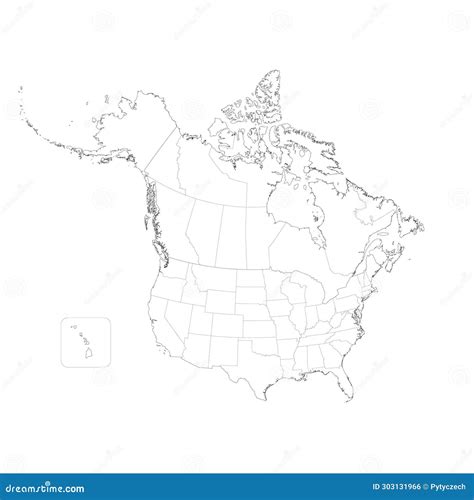
United States And Canada Blank Map

The United States and Canada are two of the largest countries in North America, with a shared border that stretches for over 8,890 kilometers. Understanding the geography and layout of these countries is essential for various purposes, including education, research, and travel. A blank map of the United States and Canada can be a valuable tool for visualizing and exploring the regions, cities, and landmarks within these countries.
Geographical Overview

The United States is a federal republic consisting of 50 states, a federal district, and several territories. It is the third-largest country in the world by land area, covering approximately 9.8 million square kilometers. Canada, on the other hand, is a federal parliamentary democracy comprising 10 provinces and three territories, with a total area of around 10.08 million square kilometers. Both countries have diverse geography, ranging from mountains and forests to coastlines and deserts.
Regional Divisions
The United States can be broadly divided into several regions, including the Northeast, Midwest, South, and West Coast. Each region has its unique cultural, economic, and geographical characteristics. Canada is also divided into several regions, including the Atlantic provinces, Quebec, Ontario, the Prairies, and British Columbia. Understanding these regional divisions can help in better navigating and exploring the countries.
| Region | Characteristics |
|---|---|
| Northeast United States | Urbanized, densely populated, and industrially developed |
| Midwest United States | Agricultural, industrial, and home to major cities like Chicago |
| South United States | Historically significant, culturally diverse, and known for its music and cuisine |
| West Coast United States | Technologically advanced, culturally liberal, and home to major cities like Los Angeles and San Francisco |
| Atlantic Canada | Coastal, maritime-based economy, and known for its natural beauty |
| Quebec, Canada | French-speaking, culturally unique, and historically significant |

Using a Blank Map for Education and Research

A blank map can be a powerful educational tool, allowing students to learn about geography, history, and cultural studies in an engaging and interactive way. By filling in the map with various features, such as state and province boundaries, cities, landmarks, and geographical features, students can develop a deeper understanding of the layout and characteristics of the United States and Canada. Researchers can also use blank maps to visualize and analyze data related to demographics, climate, economy, and other fields of study.
Practical Applications
Blank maps have numerous practical applications beyond education and research. They can be used for travel planning, allowing individuals to mark important locations, routes, and attractions. Businesses can use blank maps to visualize market trends, customer distribution, and logistical operations. Additionally, blank maps can be used in urban planning, emergency services, and environmental conservation, among other fields.
Key Points
- The United States and Canada are large and geographically diverse countries, with a shared border and unique regional characteristics.
- A blank map can be a valuable tool for education, research, and practical applications, allowing users to visualize and explore the countries' geography and features.
- Understanding the regional divisions and characteristics of the United States and Canada is essential for navigating and exploring the countries.
- Blank maps can be used in various fields, including education, research, travel planning, business, urban planning, and environmental conservation.
- When using a blank map, it's essential to consider the scale and projection used, as these can affect the accuracy and representation of geographical features.
Conclusion
In conclusion, a blank map of the United States and Canada is a versatile and essential tool for various purposes, including education, research, and practical applications. By understanding the geographical layout and regional characteristics of these countries, users can develop a deeper appreciation for the diversity and complexity of North America. Whether used for learning, exploration, or professional purposes, a blank map can provide a unique and engaging way to visualize and interact with the geography of the United States and Canada.
What is the primary use of a blank map in education?
+The primary use of a blank map in education is to help students learn about geography, history, and cultural studies in an engaging and interactive way.
How can blank maps be used in practical applications?
+Blank maps can be used in various practical applications, including travel planning, business, urban planning, and environmental conservation, among other fields.
What are the regional divisions of the United States and Canada?
+The United States can be broadly divided into several regions, including the Northeast, Midwest, South, and West Coast. Canada is also divided into several regions, including the Atlantic provinces, Quebec, Ontario, the Prairies, and British Columbia.
Meta Description: Learn about the United States and Canada through a blank map, exploring regional divisions, geographical features, and practical applications in education, research, and various fields. (148 characters)


